Forest & wildlife inventory services
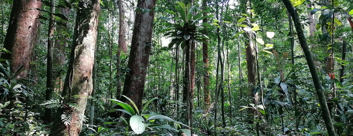
EticWood combines rigorous field methodology with satellite remote sensing, drone surveys, and GIS (Geographic Information System) analysis. The result: accurate, decision-ready data for forestry companies, government agencies, and conservation organisations, from a 500 ha concession to multi-million-hectare national programmes.
EticWood works with forestry concession holders requiring legally compliant forest management plans, including 25-year plans covering hundreds of thousands of hectares in Central Africa. EticWood has also supported the Gabonese Ministry of Forests in developing structured validation tools for annual management plans, applying precise legal criteria. Other clients include carbon project developers, conservation NGOs, and government agencies seeking independent, credible inventory data.
Project scales range from single concessions to national-level programmes. Sustainable forest management and wildlife habitat services are systematically integrated.
EticWood's inventory scope covers the full spectrum of forest and biodiversity assessment needs.
Statistical field plots measuring timber volume, species composition, stand structure, and tree-level metrics — the foundation of any legally compliant forest management plan.
Habitat evaluation, species distribution mapping, and monitoring of threatened species.
Biomass measurement and sequestration potential, aligned with VERRA (Verified Carbon Standard) protocols for carbon project development.
Detection of pest pressure, disease, and stress indicators via field observation and remote sensing data.
Seedling density and survival rates to validate natural regeneration and reforestation outcomes.
EticWood combines traditional dendrometry with modern geospatial tools, selecting the right approach for each context.
This hybrid approach delivers the accuracy required by precision forestry applications and international certification bodies.
A forest management plan is a legally mandatory document for any logging concession. It is built on statistical inventories covering timber resources, fauna, and local communities.
EticWood structures these plans around three pillars:
Minimum felling diameters and 25-year parcel rotation to ensure sustainable resource renewal.
Identification and mandatory protection of intact forest areas, hydrographic zones, sacred sites, and community resources, annexed to the management plan.
Each harvested tree receives a unique code linking the log to its stump, a prerequisite for FSC, PEFC, and PAFC (Pan African Forest Certification) certification.
EticWood's experts operate from offices in Brussels and Abidjan, with direct field presence across West and Central Africa. Inventory work is conducted with local partners, including Brain Forest for forest studies and the Smithsonian Institute for scientific research, ensuring both technical rigour and local relevance. EticWood does not subcontract blindly: all field data collection is supervised directly, and deliverables are validated against international standards before handover.



























A statutory forest management plan inventory covers timber volumes, species composition, stand structure, fauna surveys, and an assessment of local communities' resource use. EticWood conducts these inventories using statistical field plots and geospatial mapping, producing data that meets the legal requirements for concession approval and FSC/PEFC certification.
HVC (High Conservation Value) zones are areas within a concession that must be protected: intact forest massifs, sensitive watersheds, sacred sites, and resources vital to local communities. Identifying and mapping them is mandatory in any certified management plan. EticWood integrates HVC mapping into every inventory, ensuring compliance from the outset.
Each harvested tree is assigned a unique code that links the log to its stump in the forest. This chain-of-custody system is a prerequisite for FSC, PEFC, and PAFC certification, and for compliance with EUDR (EU Deforestation Regulation) due diligence requirements. EticWood supports companies in implementing these procedures from inventory through to export documentation.
Yes. Carbon stock assessment, measuring above-ground biomass and sequestration potential, is a core component of EticWood's inventory services. This data feeds directly into VERRA-certified carbon project development, including ARR (Afforestation, Reforestation, and Revegetation) projects and REDD+ conservation initiatives.
EticWood specialises in tropical forests, dense humid forests, forest-savanna mosaics, and agroforestry systems, primarily in West and Central Africa, with secondary operations in Central America and Southeast Asia. Each ecosystem requires adapted protocols: forest-savanna mosaics in Congo, for instance, require strict eligibility criteria to avoid misclassifying savanna as forest.
Contact EticWood for a scoping consultation.